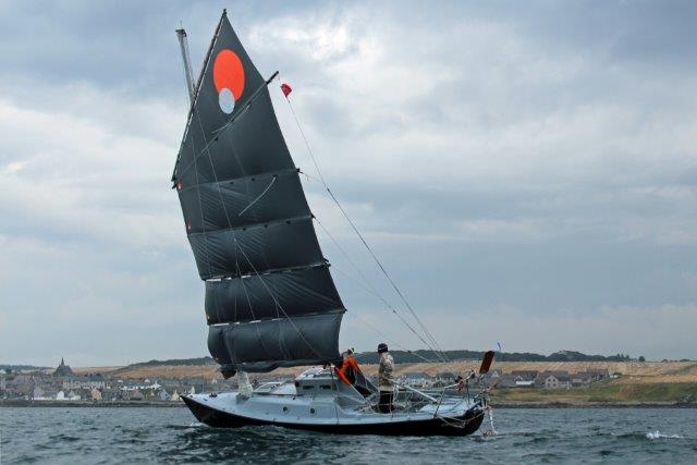
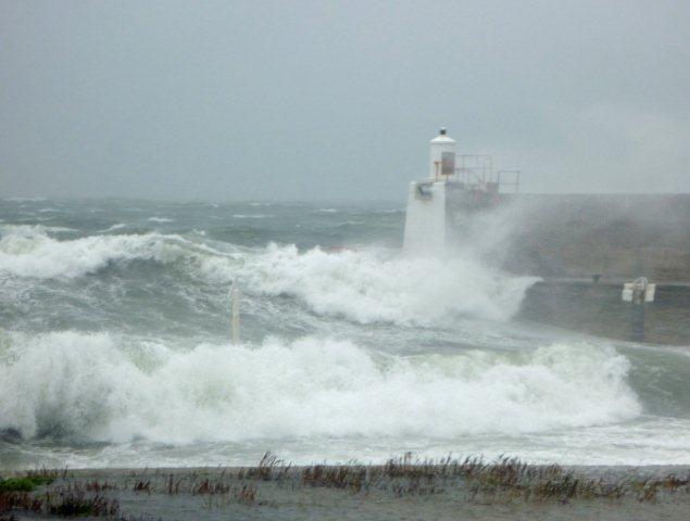
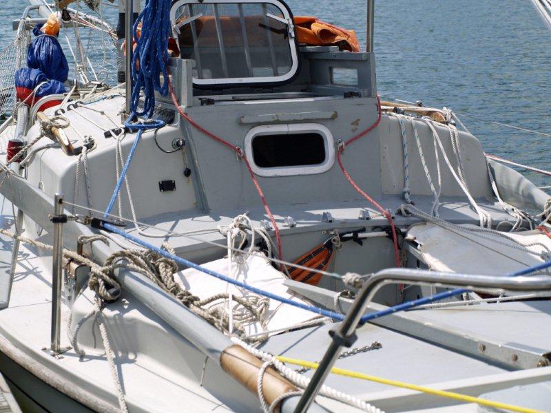
MINGMING
II's
VOYAGE 2018
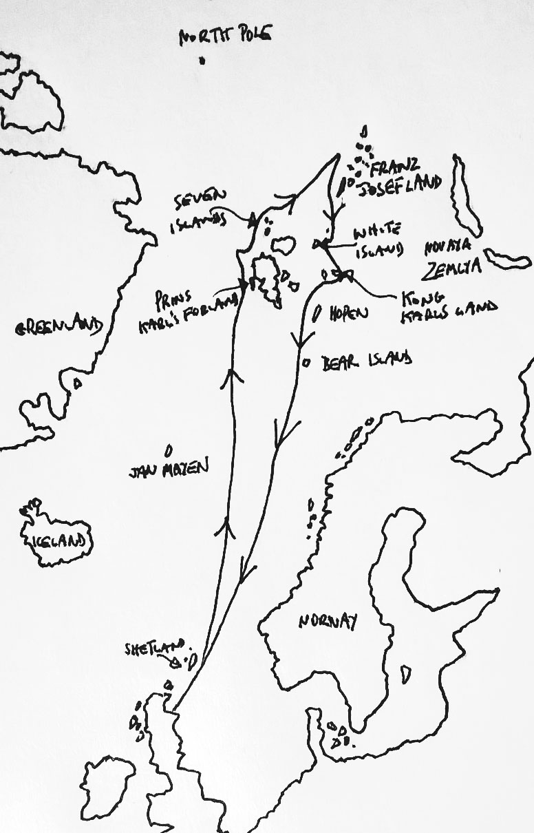
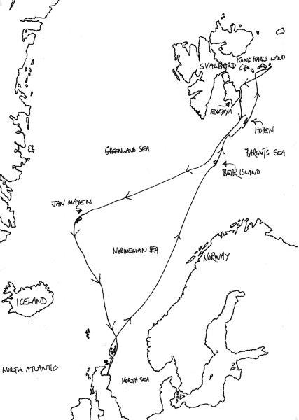
Here is the
approximate track of Mingming
II's 2018
Voyage
I
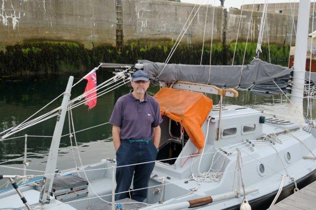
left Whitehills on the Moray Firth in the early afternoon of July
2nd, with the intention of sailing first to the north-west coast of
Spitsbergen. In misty weather, but a beneficent easterly breeze, we
made our way up the east coast of the Shetlands and struck out to the
north.
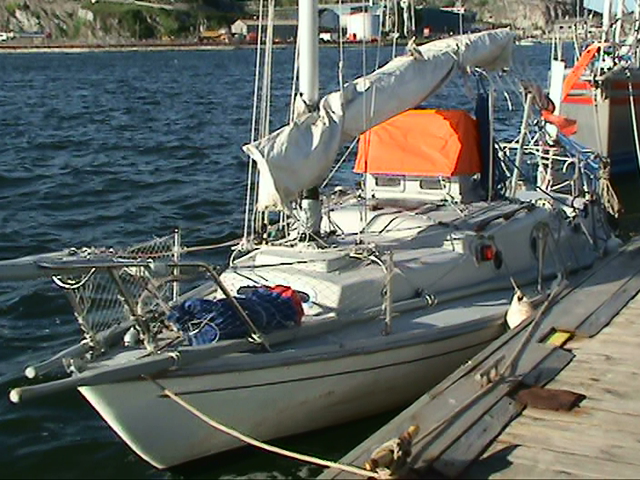
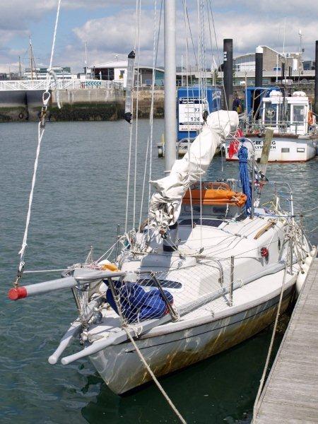
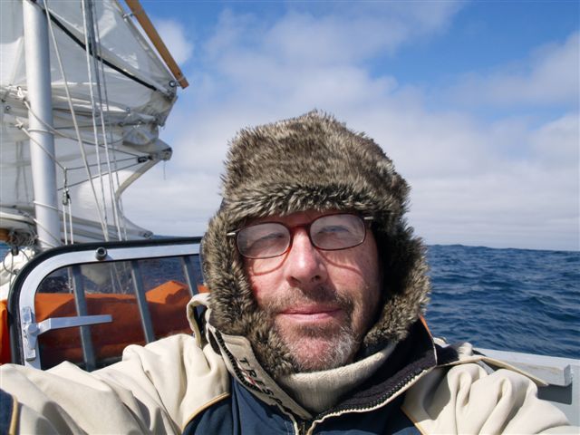
Mingming II leaves
Whitehills (Photo: Bertie Milne)
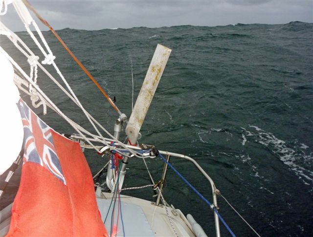
The wind soon went round to the south-west and settled there, and so we
ran on, day after day, with daily runs of up to 100 nautical miles. The
various significant lines of latitude were soon behind us: 62°North,
taking us clear of the oil rigs; 66° 33’North, taking us over the
Arctic Circle; 71°North, which put us level with Jan Mayen to the west
and the North Cape of Norway to the east. As we made our northing the
weather grew thicker and foggier. My good intentions for navigating
celestially were soon dashed as the sun, moon, stars and anything
remotely celestial disappeared behind a solid pall of murky cloud and
stayed there for most of the voyage.
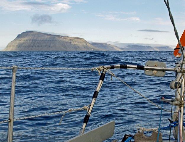
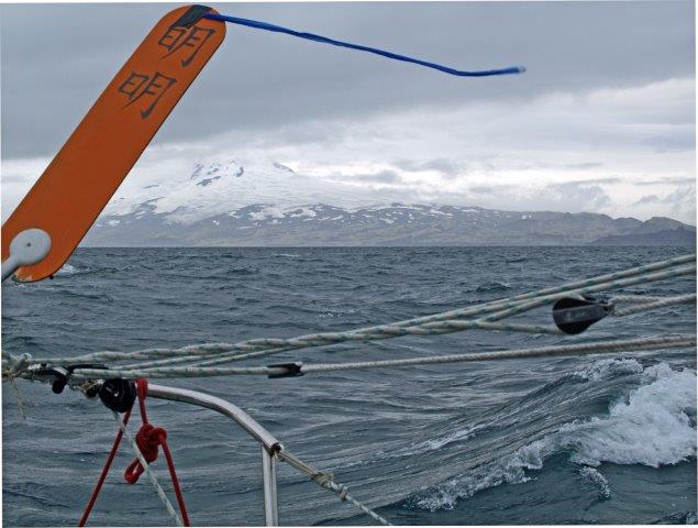
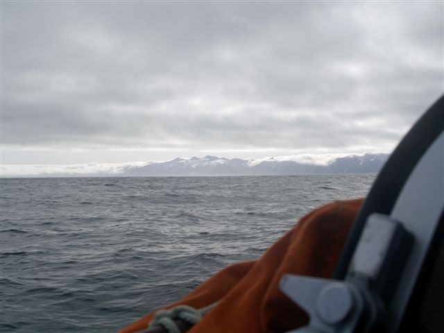
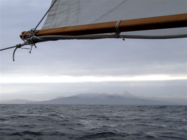
Eighteen days and the best part of 1200 miles out from Whitehills, we
closed the coast of Prins Karl’s Forland, the tall, narrow island that
runs parallel with the north-west Spitsbergen coast. I had made my
landfall at the same spot in the Corribee Mingming in 2011
under a
brilliant blue sky with the toothy peaks of Spitsbergen spread right
across the north-west horizon. This time there was nothing to see but
cloying cloud.
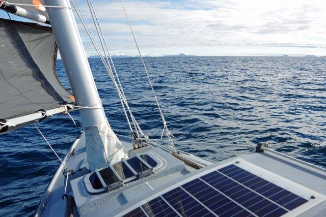
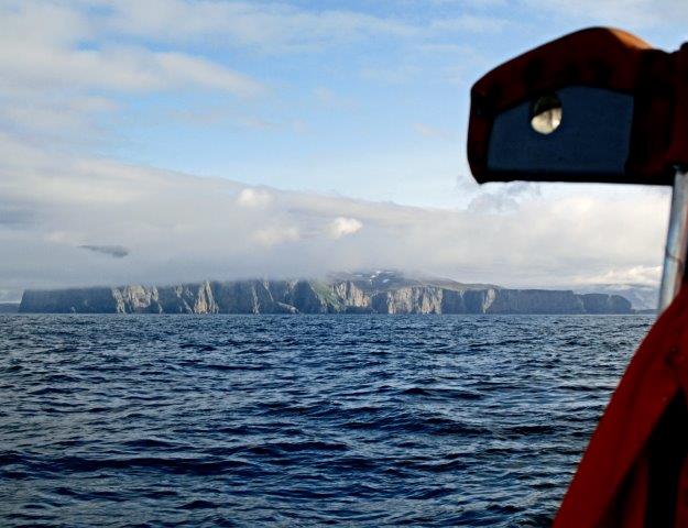
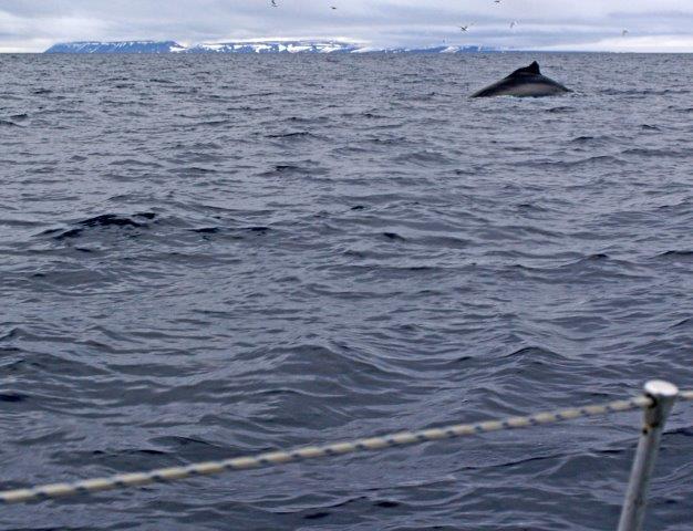
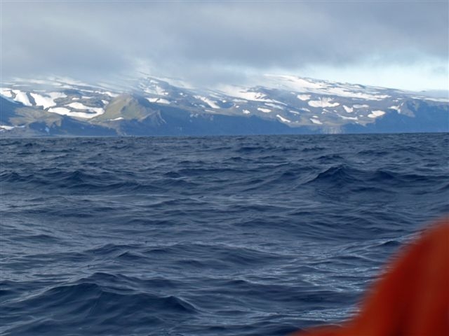
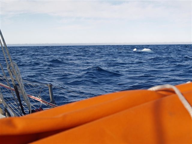
We made our way up the coast just a few miles offshore amongst a welter
of fin whale spouts and whirring guillemots. In the early morning of
July 22nd I woke to find that the sky had, for the moment, cleared. The
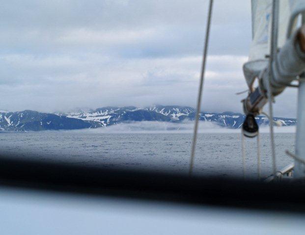
crazy, close-packed peaks and glaciers of Albert 1 Land were laid out
end to end in perfect clarity. For the first time in the voyage I felt
I was truly back in the Arctic.
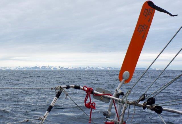
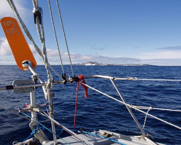
Off the coast of Albert 1 Land
A cruise ship purred by a mile or two off, packed to the gunwales with
its deep-sleeping and well-fed contingent. I was glad I was not amongst
them.
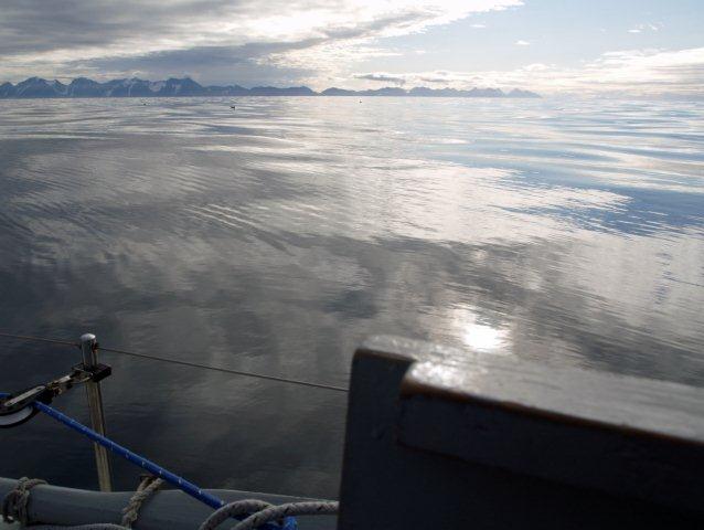
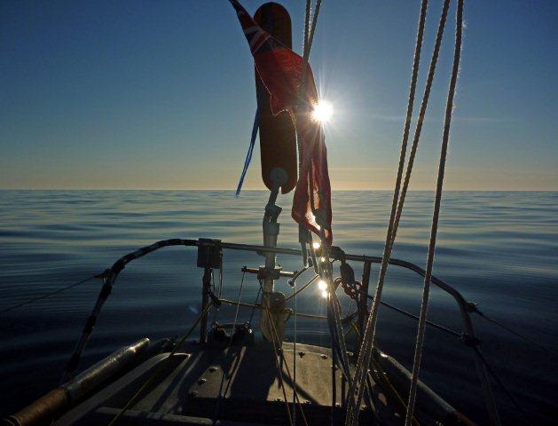
The wind swung round to the north-east and so, on a northerly board, we
passed close by the spot at 80°North reached in 2011 with Mingming, and
sailed straight on. By now my chart was little more than an expanse of
white, as we were in unsounded waters. It was a wonderful, heady
feeling to plough a wake through almost virgin sea. For a while we were
becalmed and three fearless and inquisitive puffins came and examined
Mingming II,
paddling up close and staring quizzically at this strange
and, for them, other-worldly contraption.
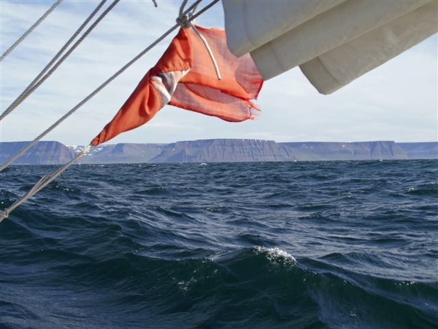
Against a veering wind we beat our way to the north-east and the first
objective of the voyage – Ross Island – the most northerly rock in
Western Europe, in 80° 50’North. This is a low doughnut of smooth
granite just to the north of the cathedral-like buttresses of Little
Table Island. Just a little way to the south of this contrasting but
close-knit pair lie the remaining, more substantial, islands of the
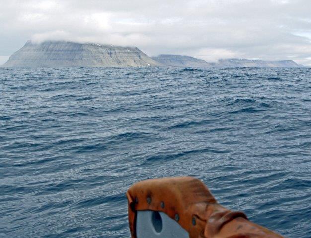
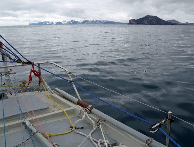
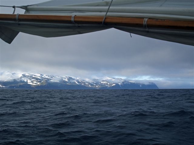
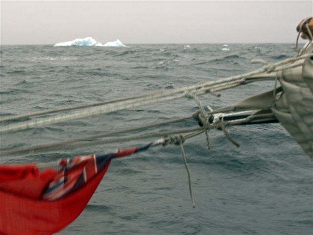
Seven Islands – Svalbard’s most northerly outliers. The clear weather
held, and in a fresh east-north-easterly and a deep indigo sea, we
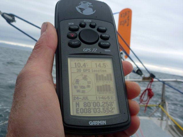
closed Ross Island and its sisters. On the afternoon of 25th July,
twenty-three days out from Whitehills, we passed to the north of Ross
Island. This is normally an impossible notion, but this year the ice
had receded far and early, and so there we were, looking south on the
world from an outrageous latitude, and little more than 500 miles from
the Pole.
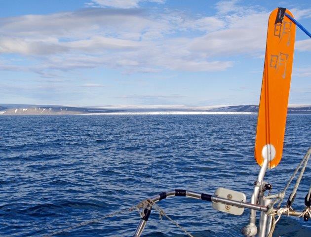
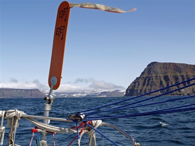
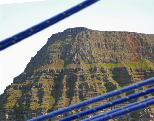
Approaching the Seven Islands
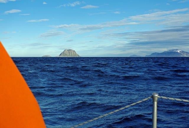
Ross Island and Little Table Island
I then struck out to the east, revelling in the surrealism of running
down our easting in 81°North. I was heading for the north-west coast of
Franz Josef Land, the Russian archipelago of 191 islands that stretch
almost to 82°North. This would enable me to fulfil the second objective
of the voyage - to sail in the Queen Victoria Sea. This sea nestles to
the north of Franz Josef Land, between the Barents Sea and the Arctic
Ocean and is rarely anything but an expanse of contorted pack-ice. It
was named by the 19th century North Pole aspirants. Many tried to cross
it and none one of them ever got out of sight of land.
I sailed gaily on, with not so much as an ice-cube in sight, until we
were a few miles off the north coast of Alexandra Land, one of the
bigger westerly islands of the group. Once again thick weather kept it
out of view. I turned north-east for a final madcap navigational fling.
I wanted to see if I could reach Cape Fligely on Rudolph Island – the
most northerly cape in Eurasia.
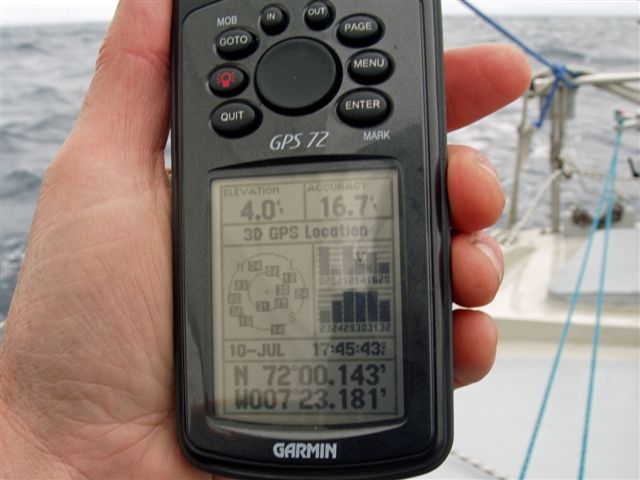
On the 29th I took a noon position of 81° 15.3’N 46°26.3’E. This was to
be the most north-easterly point of the voyage, as I found we were
being helped to the north-east, and therefore towards the pack-ice, by
a two-knot current. Were we becalmed, we risked being swept up into the
ice within a day or so. It was a risk too far, and so I turned to the
south-west to start the long haul homewards.
I had enjoyed the craziness of approaching Franz Josef Land from the
north-west, rather than the usual south, and now had the perverse
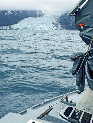
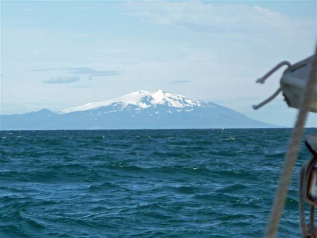
pleasure of entering the Barents Sea from the north. A headwind forced
a diversion to the north-west and so I was able to get a view of the
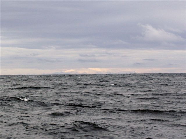
mighty dome of the wholly glaciated White Island, most easterly of the
Svalbard group. I had tried to reach this island in Mingming II in
2014, but had been turned back by ice sixty miles to the south. Under a
leaden sky its great whaleback of ice sent up a brilliant ice-glare to
the underside of the cloud.
Ice-glare over White Island
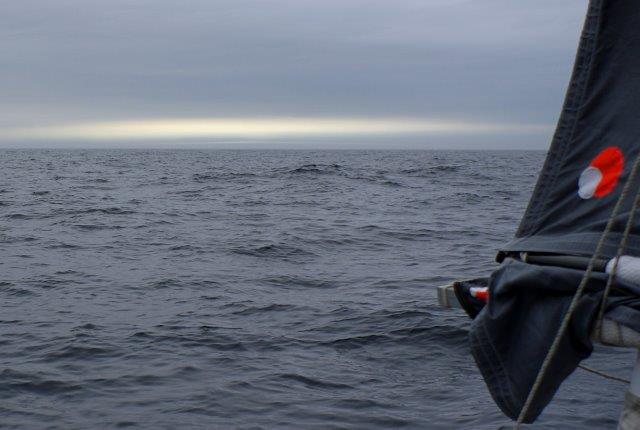
We carried on to the south-west and passed close by our most northerly
position in 2014 - 79°, just to the east of the Kong Karl’s Land group
of islands. We had thus linked up the high-points of my 2011 and 2014
voyages by means of this almost unthinkable northern loop. The weather
remained resolutely murky as we passed by our old friends from 2014:
Kong Karl’s Land, Edge Island, the Ryke Yse Islands, Hopen and Bear
Island. From time to time shoulders of cliff or the occasional headland
pushed out through the low cloud and fog, but the views were niggardly.
I was happy to have seen them all in sparkling conditions four years
earlier.
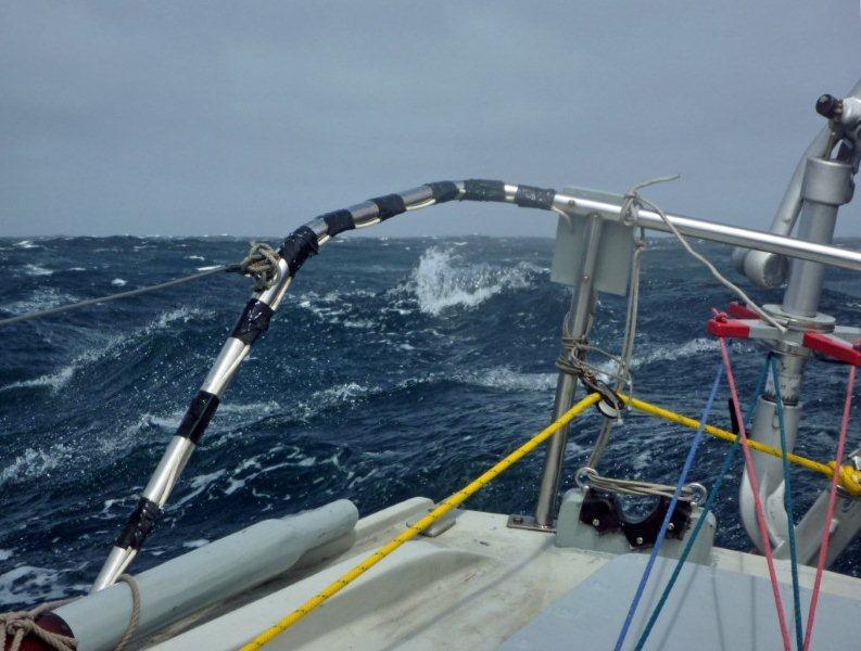
On the 7th August, after thirty-six days at sea, we took our departure
from the South Cape of Bear Island and began the final leg home. I knew
it would be tough. We would have to run the gauntlet of a storm-ridden
Jet Stream, at the same time as ploughing straight into the North
Atlantic Current. Sure enough, Mingming
II had her first taste of
really heavy weather, although the three storms we went through,
including a brief Force 9 from the south-east, were all short-lived and
relatively unthreatening. The first was from the north and we simply
ran under bare poles, covering 90 miles noon-to-noon. The second, from
the south-west, had us hove-to under a single panel. At the worst of
the south-easterly we lay-to under bare poles. Mingming II is
stiff,
totally watertight and unsinkable, and so an ideal boat to ride out the
worst in. At no point did I even get close to contemplating deploying
the Jordan Series Drogue packed in bins on the cockpit seats and ready
to launch within a minute or two.
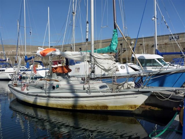
On
the evening of 27th August, twenty
days out from Bear Island, we berthed once more at Whitehills. The
voyage had taken fifty-six days. Noon-to-noon straight-line positions
totalled 3480 miles, so we had sailed the best part of 4000 miles in
all. The only running repairs I had had to make were to several batten
pockets fore and aft. Apart from that Mingming II was in as good a
state as when she left. I had been able to make all the repairs without
exiting hatches. In fact, I had only had to go on deck four or five
times during the whole voyage, once to check over the self-steering
gear, and several times to lubricate the rudder shaft. During the whole
voyage I did not wear my foul weather gear once.
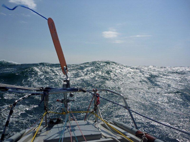
We were very rarely becalmed, as Mingming
II’s huge rig will keep her
sailing in virtually any wind. Our noon-to-noon straight-line distances
averaged just over 60 nautical miles. However my handheld GPS showed
our average speed of 2.8 knots, giving us just over 67 miles per day.
Back at Whitehills (Photo: Bertie Milne)
MINGMING
II's
VOYAGE 2014
Here is the
approximate track of Mingming
II's
2014 voyage
4
Mingming
II heading north
from Whitehills (Photo: Bertie Milne).
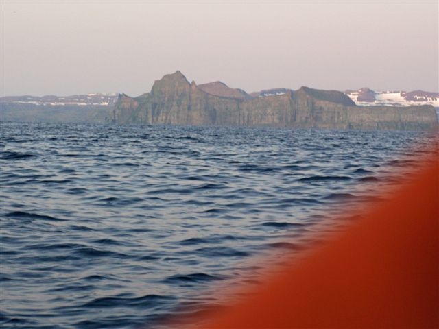
Seventeen and a half days straightforward sailing brought us to
Björnřya. We arrived off the southern end of the island late in the
afternoon of the 21st July, but it was wrapped in a blanket of fog and
cloud. I hove-to 8 miles off the southern cape, but when I looked out
at 0230, the island was crystal clear under the early morning sunshine.
We sailed in close, then up the east coast, admiring the cliffs and
mountains of the south-east side.
<br>
Approaching Bear
Island.
The south cape of
Bear Island.
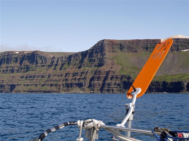
We then carried on to the north-east, in deteriorating conditions. Next
target was the island of Hopen, and I was forced to heave-to for a
while in a strong south-westerly with thick fog and torrential rain. We
were now well into the Barents Sea, and over the very shallow waters of
the Spitsbergen Banks. Just as we arrived at Hopen the weather cleared
and we entered the Arctic High. The south cape of Hopen is a massive
buttress of rock. The island is long and very narrow – only a mile and
a half wide at its widest point – but has several peaks of over 1000
feet. Once again we sailed up the east coast, filming and photographing
as we went..
Closing Kap
Thor,Hopen.
East side of
Hopen.
Humpback whale,
with Kongsoya behond.
Just a few miles past Hopen a small herd of inquisitive walruses
surrounded us. I had not expected to see them so far south.
Next target was Kong Karls Land, a group of islands 120 miles to the
north east. There I came across three massive humpback whales who
accompanied Mingming II for a short while, two of them just a few feet
off the starboard quarter. There were also small herds of harp seals
keeping us company a lot of the time. I sailed in close to the east end
of the main island, Kongsřya – King’s Island, to photograph the cliffs
and glaciers, then carried on to the most northerly, and lowest island
– Abelřya, at the north-east end of the group.
Off the eastern
end of Kongsoya.
<br><br>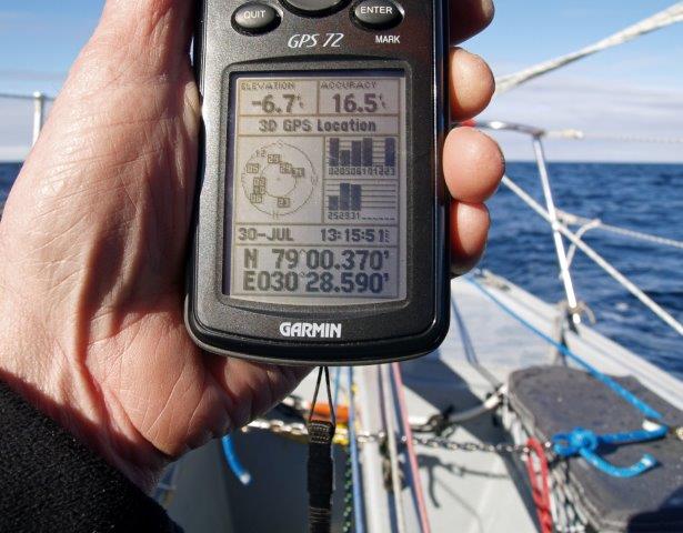
We reach 79North.
Just after midday on July 30th, off the east side of Abelřya, we
reached 79˚North. For the previous 24 hours we had been meeting drift
ice, and I decided that this was the moment to turn south again.
I then headed south-west, towards the island of Edgeřya. Edgeřya has an
ice-cap of well over 1000 square miles, which produces the huge Stone
Glacier. I sailed the whole length of the ice cliffs of the Stone
Glacier – thirty-five miles long, just a couple of miles offshore.
After the intrusion of a small mountain there is a second smaller
glacier – Kong Johanns Breen – and the next morning I was able to get
good photos in brilliant sunshine.
Off Kong Johanns
Glacier, Edgeoya.
Approaching the
Weyprecht Glacier,
Jan Mayen.
From Edgeřya I sailed south-west, past Hopen and Björnřya, out of the
Barents Sea and across the Greenland Sea for a third visit to Jan
Mayen. The extra mileage was well rewarded. For the first time I sailed
down the west side of the island, and was able to sail in really close
to the Weyprecht Glacier that descends from Mount Beerenberg, the
island’s 7000 foot volcano. Then, for the first time in all my visits
there, the cloud cleared and the great mountain was almost completely
revealed in all its icy glory. It was a spectacular sight from just a
mile offshore, rising straight out of the sea from a depth of 4500
feet.
Mount Beerenberg,
Jan Mayen.
We then turned south for home, and arrived at Muckle Flugga, the
northerly point of the Shetlands, on the evening of August 24th. After
calm weather off the Shetlands, followed by a strong blow from the
south-east, we got into Whitehills at 1830 on the evening of August
28th.
Arrival back at
Whitehills
(Photo:Bertie Milne).
The voyage was 55 days long, and noon-to-noon positions totalled 3332
nautical miles. Mingming II was a delight to sail; quick, easily
handled and relatively comfortable.
Here is the
approximate track of Mingming
II's
2014 voyage
MINGMING II's
VOYAGE 2014
I
left Whitehills on the
Moray Firth on the morning of 4th July, heading first for Björnřya –
Bear Island. Bear Island lies about halfway between the North Cape of
Norway and Spitsbergen, and is the most southerly of the Svalbard group
of islands. I ducked through the Fair Isle passage to be better placed
for a short blow form the south-east, and sailed up the west side of
the Shetlands, past my old friend, the island of Foula.
Mingming II heading north
from Whitehills (Photo: Bertie Milne).
Seventeen and a half days straightforward sailing brought us to
Björnřya. We arrived off the southern end of the island late in the
afternoon of the 21st July, but it was wrapped in a blanket of fog and
cloud. I hove-to 8 miles off the southern cape, but when I looked out
at 0230, the island was crystal clear under the early morning sunshine.
We sailed in close, then up the east coast, admiring the cliffs and
mountains of the south-east side.
<br>
Approaching Bear
Island.
The south cape of
Bear Island.
We then carried on to the north-east, in deteriorating conditions. Next
target was the island of Hopen, and I was forced to heave-to for a
while in a strong south-westerly with thick fog and torrential rain. We
were now well into the Barents Sea, and over the very shallow waters of
the Spitsbergen Banks. Just as we arrived at Hopen the weather cleared
and we entered the Arctic High. The south cape of Hopen is a massive
buttress of rock. The island is long and very narrow – only a mile and
a half wide at its widest point – but has several peaks of over 1000
feet. Once again we sailed up the east coast, filming and photographing
as we went..
Closing Kap
Thor,Hopen.
East side of
Hopen.
Humpback whale,
with Kongsoya behond.
Just a few miles past Hopen a small herd of inquisitive walruses
surrounded us. I had not expected to see them so far south.
Next target was Kong Karls Land, a group of islands 120 miles to the
north east. There I came across three massive humpback whales who
accompanied Mingming II for a short while, two of them just a few feet
off the starboard quarter. There were also small herds of harp seals
keeping us company a lot of the time. I sailed in close to the east end
of the main island, Kongsřya – King’s Island, to photograph the cliffs
and glaciers, then carried on to the most northerly, and lowest island
– Abelřya, at the north-east end of the group.
Off the eastern
end of Kongsoya.
<br><br>
We reach 79North.
Just after midday on July 30th, off the east side of Abelřya, we
reached 79˚North. For the previous 24 hours we had been meeting drift
ice, and I decided that this was the moment to turn south again.
I then headed south-west, towards the island of Edgeřya. Edgeřya has an
ice-cap of well over 1000 square miles, which produces the huge Stone
Glacier. I sailed the whole length of the ice cliffs of the Stone
Glacier – thirty-five miles long, just a couple of miles offshore.
After the intrusion of a small mountain there is a second smaller
glacier – Kong Johanns Breen – and the next morning I was able to get
good photos in brilliant sunshine.
Off Kong Johanns
Glacier, Edgeoya.
Approaching the
Weyprecht Glacier,
Jan Mayen.
From Edgeřya I sailed south-west, past Hopen and Björnřya, out of the
Barents Sea and across the Greenland Sea for a third visit to Jan
Mayen. The extra mileage was well rewarded. For the first time I sailed
down the west side of the island, and was able to sail in really close
to the Weyprecht Glacier that descends from Mount Beerenberg, the
island’s 7000 foot volcano. Then, for the first time in all my visits
there, the cloud cleared and the great mountain was almost completely
revealed in all its icy glory. It was a spectacular sight from just a
mile offshore, rising straight out of the sea from a depth of 4500
feet.
Mount Beerenberg,
Jan Mayen.
We then turned south for home, and arrived at Muckle Flugga, the
northerly point of the Shetlands, on the evening of August 24th. After
calm weather off the Shetlands, followed by a strong blow from the
south-east, we got into Whitehills at 1830 on the evening of August
28th.
Arrival back at
Whitehills
(Photo:Bertie Milne).
The voyage was 55 days long, and noon-to-noon positions totalled 3332
nautical miles. Mingming II was a delight to sail; quick, easily
handled and relatively comfortable.
Back
to top
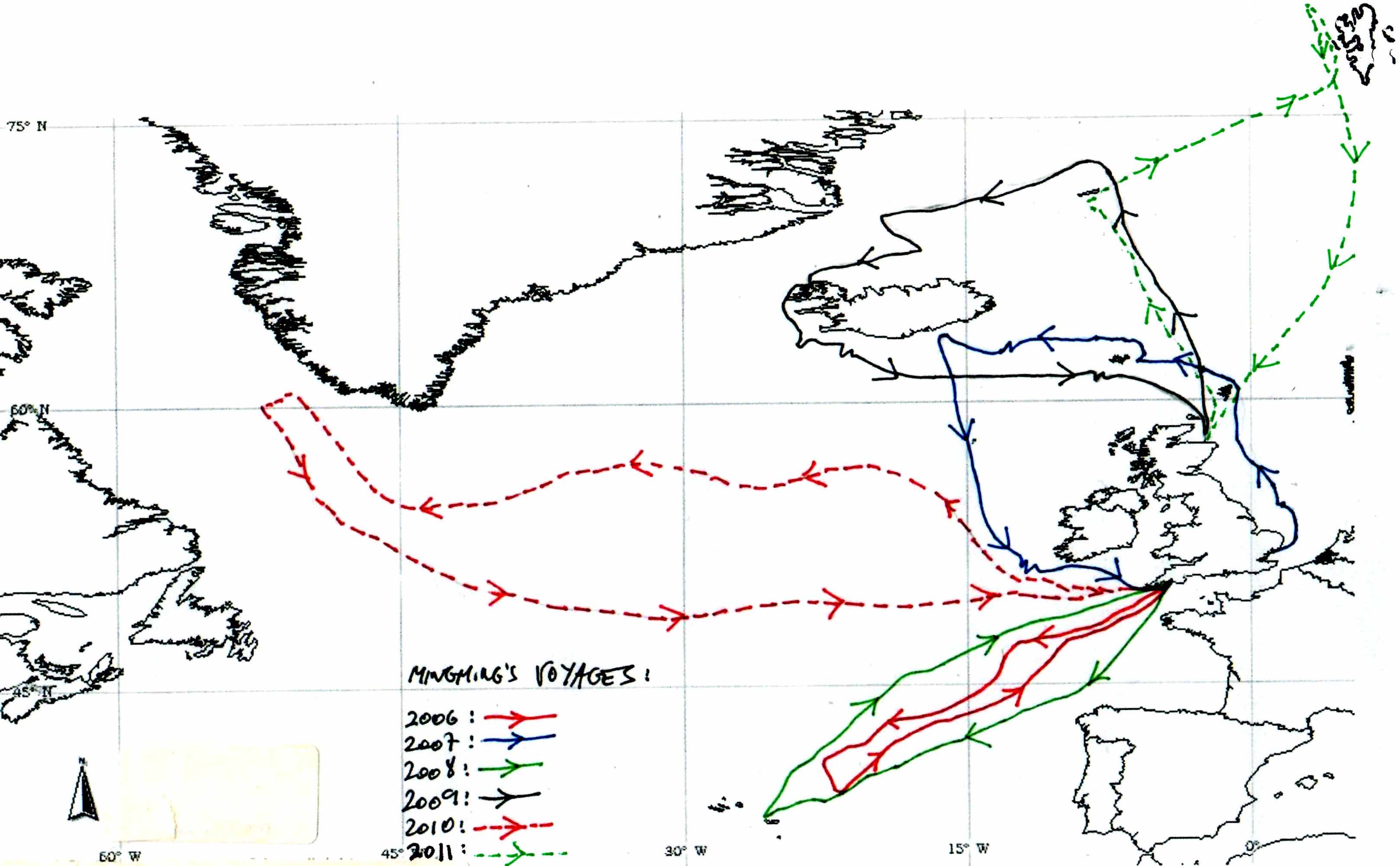
Here are the
approximate tracks of Mingming's
voyages 2006 - 2011
MINGMING'S
VOYAGE 2011
Left
Whitehills harbour on the Moray Firth at 1700H on Thursday 23rd
June. Sailed north through the Fair Isle Channel, heading first for Jan
Mayen. We crossed the Arctic Circle a week later. A few hours after
crossing into the Arctic the stitching in two seams on the third panel
started to fail, no doubt as a result of chafe against the topping
lifts. One of the seams was in a very difficult position to repair so I
dispensed with that panel entirely, lashing two battens together. We
had covered c.550 nautical miles at the time and so sailed the
remainder of the 3000 mile voyage minus one panel. This probably
disadvantaged us a little in the extremely light airs we were to
encounter further north.
Mingming
at Whitehills prior
to our voyage.
We met our first period of very calm weather about 80 miles south of
Jan Mayen, with six days of virtually no wind. On Monday July 4th, just
after midday, 65 miles south-south-east of the South Cape of Jan Mayen,
a yacht, motor sailing, overtook us about a mile on our starboard beam.
We reached Jan Mayen on July 7th, after two weeks at sea. As last time,
had a fantastic day sailing up the east coast. I had a proper chart of
the island this time, so was able to go in a lot closer. Unfortunately
Mt Beerenberg, the 7000' volcano, was once again under cloud cover, so
I did not see the summit.
Misty morning
off
Jan Mayen.
The headland
Eggoya, central Jan
Mayen.
Headed north-east from Jan Mayen, bound for Spitsbergen. Two days later
a northerly gale knocked us down quite badly. I was in my bunk at the
time and felt the mast go way beyond the horizontal. A lot of chaos
inside, but the only damage was bent framing on the spray hood.
We made our landfall
at Spitsbergen, at
Prinz Karls Forland on the north-west coast, on Wednesday 20th July,
after 26 days at sea. Sailed north up the coast, making sure to keep
beyond the 12-mile limit (the regulations for yachts sailing in
Svalbard waters are draconian). Fantastic views of the Spitsbergen
mountains, stretching to Albert 1 Land in the north. At one point I
counted 73 peaks. Several times encountered relatively (for these days)
large concentrations of whales along the continental shelf, mainly fin,
with some humpback, minke and at least one sei whale. This surfaced
very close and I was able to identify it from the photos I took.
Landfall at
Spitsbergen.
Becalmed off
Prinz Karls Forland,
Spitsbergen.
Glassy calm off
Spitsbergen.
I carried on north, hoping for the right wind to make a dart for 80°N.
Had to be careful here, as there would have been ice to the west and
north, and land and ice to the east: a potentially awkward trap. After
some concern with a hard blow from the south-west, the wind settled at
west-north-west, giving me the perfect angle to sail quickly north,
then south again. Reached 80°N at midday on Sunday July 24th, after
just less than 31 days at sea and nearly 1600 miles of sailing.
The mother of
all
noon positions.
2am calm in the
high Arctic.
Turned immediately south and began the long haul home. I had intended
to sail a westerly route, using the East Greenland current, and giving
us another look at Jan Mayen. However a week of south-westerly
headwinds put paid to that, forcing me to sail the direct route home,
and putting us into the north-going North Atlantic current. Eleven days
of strong northerlies helped break the back of the return leg, bringing
us to within striking distance of Viking. The weather then turned very
sour, with a constant mix of calms and headwinds. As we approached the
Shetlands the weather systems became increasingly unstable, with
depressions springing up all round and following unusual tracks.
Finally got to within 20-30 miles of Whitehills and were once more
becalmed. I was very concerned, as the forecast was for extremely
strong northerly winds - not what you want when approaching the south
coast of the Moray Firth. A fortuitous mix of a light easterly followed
by a moderate north-westerly enabled us to cover the last few miles and
get safely into harbour before the storm struck. Within less than a day
of tying up in Whitehills it was blowing Force 9 to 10 straight onshore.
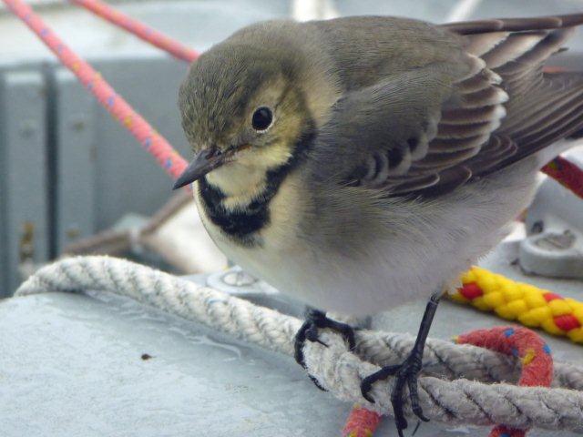
Hitch-hiker 150
miles west of Norway
- juvenile white wagtail.
The entrance to
Whitehills Harbour
24 hours after our arrival.
The voyage took 65 days (31 days out, 34 days back) and we logged just
over 3000 nautical miles. This was an interesting contrast to last
year's voyage to west Greenland, in which we covered over 4000 miles in
about the same time. Mingming has now sailed nearly 20,000 miles in six
years, mainly in high latitudes. I am now thinking seriously about
giving her a well-earned rest.
Back
to top
MINGMING'S
VOYAGE 2010
No ice
or dramatic coastlines this year. Took our departure from Bishop Rock
on May 25th, two days after leaving Plymouth, and arrived back at
Bishop Rock 62 days later. During those 62 days we were never close to
land and saw less than six other vessels. For one period in the
north-west Atlantic, Labrador Sea and Davis Strait we went 34 days
without seeing any ships.
The
voyage had two
objectives: firstly to get to the west of Greenland, and secondly, if
conditions allowed, to penetrate the Davis Strait as far as the Arctic
Circle. For the outward leg I went north fairly quickly, then ran west
between 55°N and 57°N. In theory this is far enough north to get the
easterly air flows of the depressions, and far enough south to avoid
the severe storms and sea ice associated with Cape Farewell,
Greenland's southern tip. This worked pretty well. We of course had
plenty of heavy weather, but you cannot expect anything less at those
latitudes at any time of year. Once well to the south-west of Cape
Farewell I then shaped a course to run north-west through the Labrador
Sea and into the Davis Strait.
Heavy
weather,
mid-Atlantic.
A south-easterly gale which started on June 24th built for a day and a
half. We were running before it quite comfortably under bare poles. At
0015H on the morning of June 26th, at which point we were about 130
miles west of Cape Desolation on the west Greenland coast, a rogue wave
caught us on the wrong quarter, gybing us round and then putting Mingming
on her beam ends. I had been dozing on the safe,
downhill
side of the boat. The gybe moved me to the uphill side, and as we went
over I was flipped over onto my back and thrown across the cabin,
catching my right side against the corner of the chart table. I did not
realise immediately that I had injured myself. My first concern was for
my back, which had been wrenched during this short haul flight and
awkward landing. It was only a few minutes later, when I was getting us
back on the correct heading, and had to reach for a steering line with
my right hand, that I heard, as much as felt, a loud 'click' from my
right rib cage - the click of two pieces of displaced bone slotting
themselves back together again.
Heavy
weather,
Labrador Sea.
After a great deal of thought I decided that it wasn't a good idea to
keep on north up the Davis Strait. I had no idea of the extent to which
a broken rib might incapacitate me. I certainly did not want to be
coping with dangerous ice conditions when physically hampered. The
first objective of the voyage had been fulfilled; I would have to
settle for that. The storm came off over the next 12 hours, and at
midday on June 26th, after 34 days at sea, I reluctantly turned for
home. At that point we were in 60° 42'N 53° 29'W.
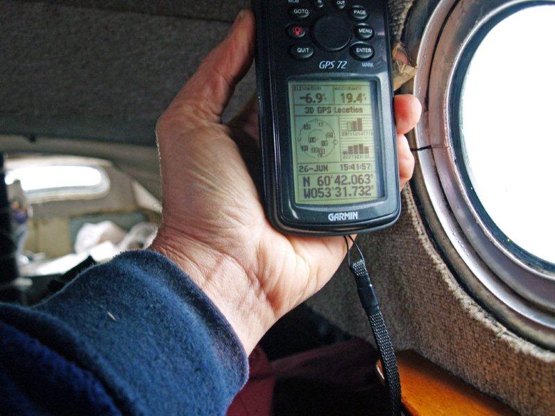
The
turning point
of the voyage.
The return leg was a kind of inversion of the outward route. This time
I headed south-east quickly, to get myself to 50°N and then run down my
easting directly to the Lizard. I hit 50°N round about 28°W, and had an
almost unbroken run of following westerly weather, and the benefit of
the North Atlantic Current, to drive us home. I brought
Mingming
into Plymouth at 0830H on 29th July, after 67 days at sea.
Mingming
back at Plymouth after 67 days at sea.
Mingming
back at Plymouth after 67 days at sea.
As someone with a fanatical interest in pelagic wildlife, and a
lifelong ornithologist, the highlight of the voyage came at 1010H on
Tuesday 13th July, when we had a very close encounter with, of all
things, a black-browed albatross. Albatrosses are of course extremely
rare in the northern hemisphere. As I was in bird photographer mode,
brought on by many weeks spent in the wintering grounds of another
southern hemisphere breeder, the great shearwater, I was quick enough
to take four shots of the albatross, despite the whole encounter lasing
not more than forty seconds. I now have a photograph I will treasure
for the rest of my life - Mingming and an albatross
in the same
frame. Absolutely amazing. The black-browed albatross, by the way, has
an 8 foot-plus wing span.
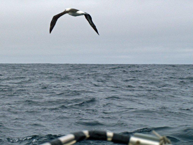
Mingming
meets a black-browed albatross.
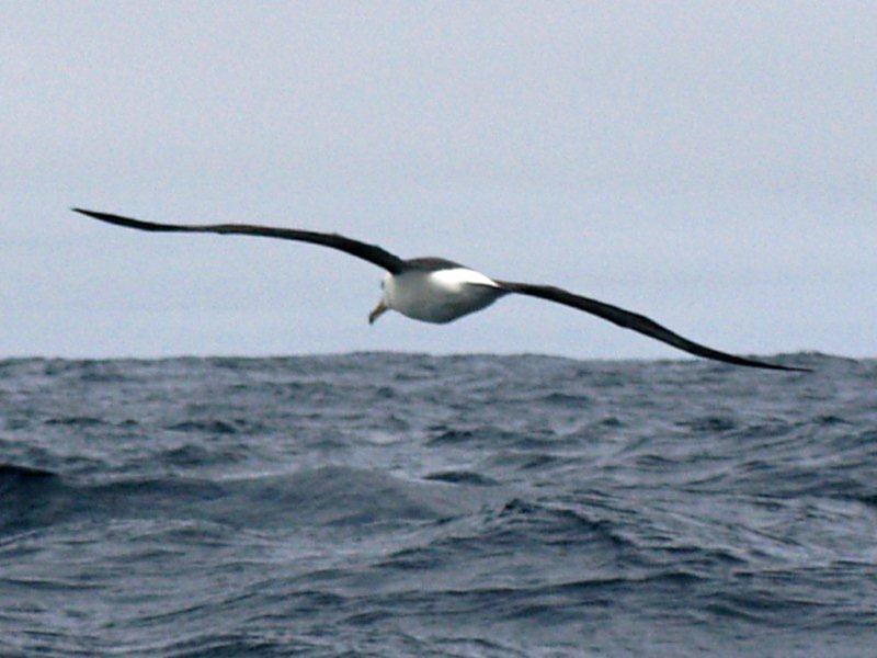
Amazing!.
The statistics for the voyage are as follows. For the outward leg the
noon-to-noon (straight-line) distances totalled 1995 miles, covered in
34 days at an average of 59 miles a day. The return leg totalled 2090
miles in 33 days at an average of 64 miles per day. Worst day was 10
miles (no wind), best was 100 miles (twice). Total distance sailed was
therefore 4085 miles at an average of 61 miles per day. Mingming
and
I have now covered about 16,000 ocean miles.
Back
to top
MINGMING'S
NORTHERN VOYAGE
2009
Left Whitehills
Harbour on the Moray
Firth, northern
Scotland, at high water, 0200H on Friday 26th June. Ran up through the
Fair Isle Channel, past Fair Isle, then outside Foula, the westernmost
Shetland island. With settled weather from the east, though with
occasional calms, I was able to lay down an almost straight track to
Jan Mayen, which we reached 121/2 days later, on Wednesday 8th July.
The highlights of the leg to Jan Mayen were two encounters with pods of
killer whales, and a close shave with a Russian factory trawler, the Armanek
Begayev, of Kaliningrad, which we met just inside the Arctic
Circle. We had crossed the Arctic Circle, 66 33N, at about 0800H on
Saturday 4th July, 8 days after leaving Whitehills.
The
mountains of south Jan Mayen
Sailing
north-east along the base of Mt Beerenberg, Jan Mayen.
Spent two days close inshore at Jan Mayen, the first sailing up the
east coast, the second becalmed off the north east end of the island.
The scenery was magnificent, the only disappointment being that Mt
Beerenberg, the 7000' volcano that dominates the north end of the
island, was permanently shrouded in cloud.
Sailing
north-east along the base of Mt Beerenberg, Jan Mayen.
A
proud moment as we reach 72N.
As
we approach the Greenland coast ice floes start to appear.
From the North Cape of Jan Mayen I sailed on due north, partly out of
necessity (we had a brief north westerly wind) and partly from choice
as I wanted to reach 72N before turning west towards the Greenland
coast. This we did at 1840H on Friday 10th July. Then headed west
towards the East Greenland coast, in search of ice, meeting our first
floes on the late afternoon of Sunday 12th July. Spent about 24 hours
in sea ice of low density, but towards 2300H on the evening of Monday
13th July, about 80 miles east of Scoresby Sound, began to encounter
small bergs and bergy bits in dangerous concentrations. After a small
bergy bit had wedged itself under the starboard quarter for a few
seconds I decided that we had seen enough of what we had come to see,
and started to retreat rapidly east. This was none too soon, as a few
minutes later I could see a line of unbroken pack ice to the south,
directly to leeward. Having got clear of the ice I sailed south east to
get out of the East Greenland Current and away from any stray bergs or
floes.
Amongst
bigger bergs and bergy bits.
Horn,
one of the headlands of north-west Iceland.
Entering
Adalvik, Iceland's most north-westerly bay.
Leaving
Adalvik, with the headland Ritur to starboard.
Close-up
of the headland Ritur, showing the amazing geology.
Looking
south down Iceland's west coast, along the headlands of the Vestfirdir,
the western fjords.
At this point I was undecided whether to go south via the east coast of
Iceland, or to carry on with the third objective of the voyage - a
passage through the Denmark Strait between Iceland and Greenland.
Finally decided to go for the latter, so shaped a course south west to
take us to the north west headland of Iceland, Stromnes. We reached
here on Monday 20th July. In deteriorating weather we closed the coast
and I eventually decided, somewhat against my better judgement, to
enter Adalvik, Iceland's most north-westerly bay, immediately to the
south of Stromnes. Got into the bay, but despite a F6 north-easterly
blowing outside, were totally becalmed for almost 4 hours, at the mercy
of a mix of tides and currents evidently at work thereabouts. By this
time I had given up all thoughts of sailing to the head of the bay to
anchor. As soon as some wind finally came in we scooted offshore again
as fast as possible. Had a good run down the west coast of Iceland in a
cold north-easterly, the seascape dominated for two days by the
Snaefellsjokull, the glacier at the end of the peninsula in central
west Iceland.
Sailing
south under the lee of the Snaefellsjokull.
Hove-to
under series drogue off south-west Iceland.
We skirted round the end of the Reykyanes Ridge that extends 40 miles
off the south west tip of Iceland, with its shoals and skerries. At
that point I had a 'nearly home' moment, although there was still
nearly 800 miles to go. Any hopes of a fast passage back to Scotland
werre soon dashed as we met constant calms and light headwinds,
interspersed with the worst storm I have encountered in Mingming.
We lay to Mingming's series drogue for 12 hours
and, after that
parted through chafe caused by a silly mistake on my part when setting
it, another 5 hours under my home-made B & Q sand-bag sea
anchor.
Off south west Faeroes we were badly held up again with a F7 from south
east that blew for a good four days. Finally arrived back at Whitehills
at 0930 on the morning of Thursday 13th August, the last 800 miles
having taken 20 days.
Mingming
back at Whitehills harbour, with 48 days at sea showing above the
waterline.
Our noon to noon daily runs totalled about 2700 miles, although we of
course sailed a lot further. By far the most interesting and
challenging voyage I have made, with 16 days spent inside the Arctic
Circle. For once we achieved all our objectives. Mingming
was,
as ever, amazing, and the insulation I had put in over the winter made
her incredibly comfortable, even in water at nearly zero degrees.
Back to top
MINGMING'S
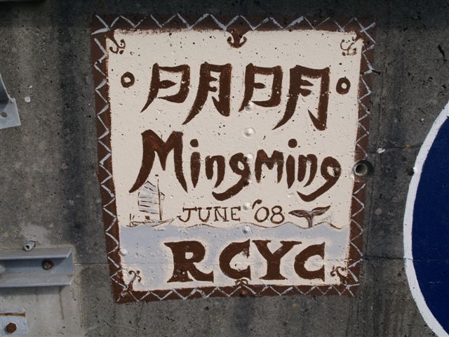
JESTER AZORES
CHALLENGE 2008
Leaving
Plymouth, with Jester
herself astern
The outward
leg
took just under 21
days. Apart from a half gale in the Bay of Biscay, I had very
favourable sailing for the first 12-13 days and thought I was on course
for a fast time. However the weather always has the last say. The last
300 miles took 8 days with constant south westerlies, either 0-1 or
6-8. I was within 40 miles of Terceira for a good two days, but could
make little progress against massive seas and vicious headwinds. The
strong southerly set to the east of the island did not help either. The
wind finally veered north, giving me a good lead into the harbour at
Praia da Vitoria.
The harbour and
marina at Praia da
Vitoria
Looking down
at Praia da Vitoria
Mingming
leaves her mark in
the Azores
Farewell to the
Azores
After a fabulous three and a half days on the island it was time to
head for home. The voyage back to Plymouth took just 16 days. Winds
were F6 or more for 11 out of the 16 days, but were all favourable,
hence the fast time. At one point it blew 6-7, with the odd F8 gusts,
for 8 consecutive days without let-up, constantly from WNW. As ever, Mingming
handled the conditions with consummate ease.
MINGMING'S
NORTHERN VOYAGE 2007
Left
Burnham-on-Crouch 0915 22 June. Three days later we ran into a severe
gale off the N Yorks coast. This was the storm that caused the first
lot of flooding across the UK. I had to sail quite aggressively to
maintain position. Winds were NE backing N then NW. I had the coast to
the west, Dogger Bank to the east and the shallower waters of the
Humber, plus the gas rigs, to the south. Fortunately I had had enough
time to get Mingming into deeper water with reasonable sea-room. Two
days later, probably because of strains imposed during this storm, my
top two battens broke. These were fixed with boathooks, brush handles
and bits of spare wood. This patched up rig took me the well over 2000
miles. We had to ride out a less severe storm half way up the Scottish
coast.
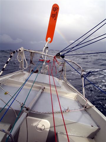
Rainbow off the
East Coast
Eleven and a
half
days after leaving
Burnham we rounded the northern tip of Unst, the most northerly island
of the UK. Magical moment. Three days later we were off the east coast
of the Faroes. Here we started running into strong northerly headwinds.
The next day a third batten broke. More patching up. I was heading for
NE Iceland but F7 northerlies kept forcing us further and further west.
With the broken rig I could not sail too aggressively to windward.
Between the Faroes and Iceland we had a pod of 200 plus pilot whales
with us for 5-6 hours. I took some amazing video of this.
An atmospheric
view
of Unst, Britain's
most northerly island
The consistent
northerlies finally put
NE Iceland and the Arctic Circle out of reach. Highest latitude reached
was 63 12N, about 200 miles short of the Arctic Circle. I decided to
head west towards the Vestmann Islands - SW Iceland. Friday 13 July, 21
days out from Burnham, was my day for turning back. At 0815 I was
finally rewarded when the mighty Oraefajockull - the 7000' glacier on
Iceland's south coast, appeared on the horizon. We were about 55 miles
south of the central south coast.
Dressed for the
North!
Iceland's
highest
glacier, the
Oraefajokull, appeared low on the northern horizon
We
then ran south
to Rockall. The northerlies persisted, giving us nearly a week of fast
sailing. We passed Rockall itself 50 miles to the west. A F7
northeasterly was blowing, with big seas - not the weather to venture
onto the shallow waters of the Rockall Bank. We followed the 500 metre
contour line down the west side. Then down towards Ireland. 130 miles
west of Ireland we met a second pod of pilot whales, again about 200.
This time the light was good for still shots.
Pilot whales
130
miles west of
Ireland. Amazing!
The
lows then
started rolling in - five in all. The first - through Sole, was the one
that caused the second round of major flooding. I did my best to dodge
them, at one point spending two days holding my position in F7-8
weather about 80 miles west of the Fastnet Rock, waiting for the right
moment to cross the Celtic Sea. This came with strong but benign
westerlies and I crossed in two days. A final low and a good dusting
south of the Lizard kept me on my toes to the end. Towards midnight on
29 July, 37 ˝ days out from Burnham, we dropped anchor in Cawsand Bay,
Plymouth Sound. Next day I brought Mingming in to Plymouth Yacht Haven.
Jury-rigged
battens
fixed with
boathooks and brush handles.
A
fantastic voyage.
Very tough, with plenty of heavy weather and cold conditions. But the
northern waters were magical. From the Shetlands to western Ireland I
saw less than ten other vessels. Total distance sailed was about 2500
miles - so in time and distance it was almost identical to last year's
Azores voyage. Mingming was again brilliant - an extraordinary little
seaboat, always at ease in the big stuff.
|